Chiang Mai to Pai, the 762 Curves
- Chiang Mai to Mae Hong Son
- From and to
- 131 km
- Distance
- Half Day
- Riding time
- November - February
- Best season
- Intermediate
- Level
- Road
- Surface
Passes throughChiang MaiMae RimMae TaengPai
- Sights 5
- Coffee 9
- Food 3
- Stay 6
Elevation
- 131 km
- Distance
- 1,555 m
- Total climb
- 1,397 m
- Highest point
- 317 m
- Lowest point
The ride
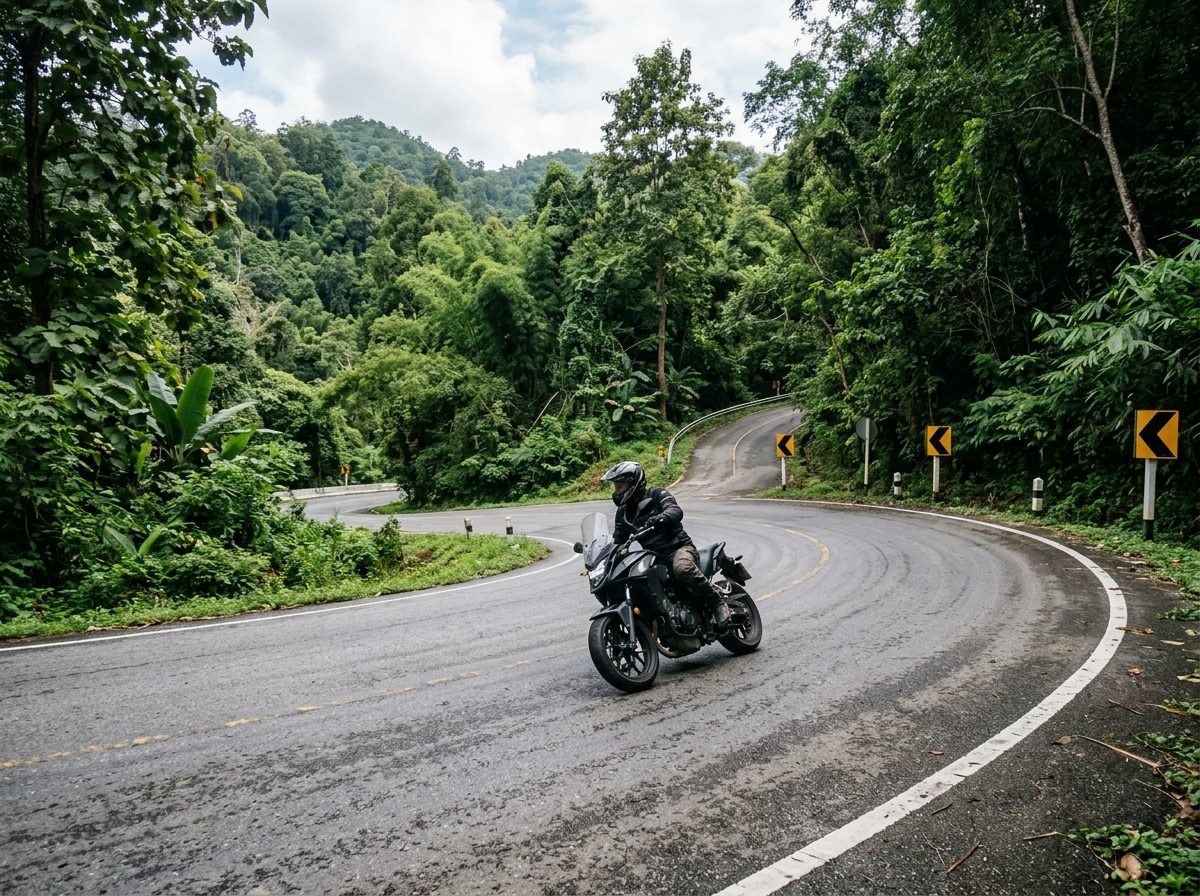
The famous road to Pai. Ride north on Road 107 to Mae Malai, then turn onto Road 1095 and count the bends: 762 of them over the mountains to Pai. The surface is good but the road is busy with minivans that cut corners, so keep to your side on the blind ones. Stop at the viewpoints near the top, and at the Memorial Bridge just before town.
Before you go
This track was drawn from a map, not recorded on a ride. Check road conditions locally before you set out.
Along the way
23 places we'd pull over for within 2 km of this route. They are marked on the map above; the distance is how far into the ride each one comes.
Sights5
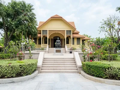
Darapirom Palace Museum
Mae Rim, 14 km in
The teak residence of Princess Dara Rasmi, kept as a museum with her rooms and belongings much as they were. Signed a short way east of the highway at Mae Rim.
Open in Google Maps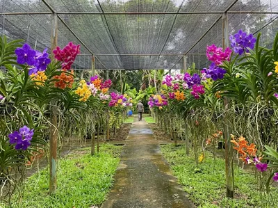
Bai Orchid and Butterfly Farm
Mae Rim, 16 km in
Rows of vanda orchids hanging under shade netting with a butterfly house alongside, on the Mae Rim tourist strip. A short, easy stop between the bigger attractions.
Open in Google Maps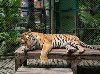
Tiger Kingdom
Mae Rim, 16 km in
The tiger attraction on the Mae Rim road, where visitors are taken into the enclosures with the animals. The restaurant serves a tasty Thai lunch, and you can watch the tigers from there if you're not sure about going into the cages.
Open in Google Maps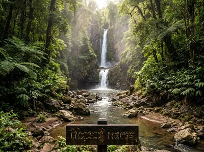
Mok Fa Waterfall
Mae Rim, 54 km in
A tall waterfall in Doi Suthep-Pui national park, signed off the 1095 on the way to Pai. Ten minutes down a path from the car park, and cool even in April.
Open in Google Maps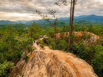
Pai Canyon
Pai, 123 km in
Narrow sandstone spines you can walk out along above the valley, signed off the 1095 just south of Pai. The drops are real and the sand is loose, so keep your boots on.
Open in Google Maps
Coffee9
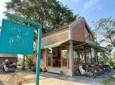
Rab-a-bit
Mae Rim, 18 km in
Brick, glass and a turquoise sign on the Mae Rim road, with bikes usually lined up outside. A tidy first or last coffee if you are riding out of Chiang Mai to the north.
Open in Google Maps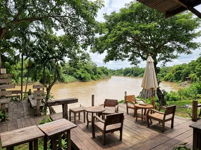
Elely Cafe
Mae Rim, 32 km in
Chairs on a deck right above the brown water of the Mae Taeng river, a short way off the main road north. Their two elderly elephants wander down to the river periodically, and the cafe has some personable dogs.
Open in Google Maps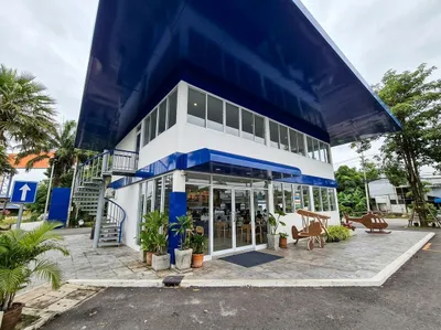
Air Diamond Cafe
Mae Rim, 33 km in
A Black Canyon coffee shop inside an old Airbus A330 parked just off the road north through Mae Taeng, with an airport-terminal check-in out front. A gimmick and definitely overpriced, but memorable.
Open in Google Maps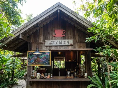
Pankled Coffee
Mae Rim, 54 km in
Timber-fronted place with the drinks list chalked up under the gable, on the winding stretch of the 1095 north of Mae Taeng. Shade, a cold drink and somewhere to stretch.
Open in Google Maps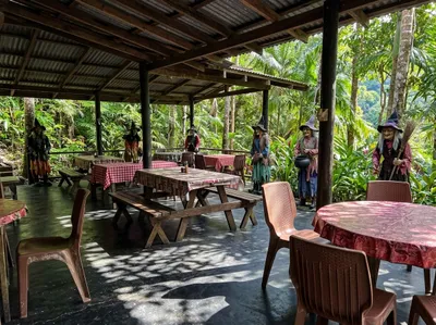
Coffee We/Witch’s House
Pai, 80 km in
Picnic tables under a tin roof with painted witches propped along the rail, on the 1095 between Mae Taeng and Pai. A daft and welcome break in the middle of the curves.
Open in Google Maps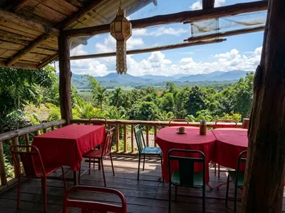
Coffee in Love
Pai, 128 km in
The valley view that ends up on everyone's photographs, seen from a covered deck of red tables just south of Pai on the 1095. Busy in the middle of the day, quieter early.
Open in Google Maps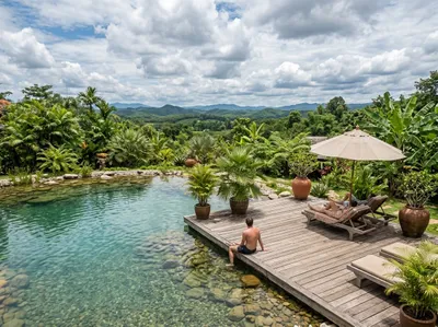
Reverie Siam Resort
Pai, 130 km in
A garden resort on the west side of Pai with a spring-fed pool and a deck for lounging. Worth knowing about if you want a soft night in the middle of a hard week.
Open in Google Maps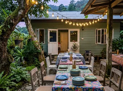
Carrot on the Moon
Pai, 131 km in
Long tables in a lantern-lit courtyard just off the Pai walking street, laid up for the evening. A sit-down meal and a drink rather than a grab-and-go coffee.
Open in Google Maps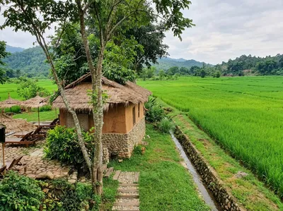
Countryside Resort Pai
Pai, 131 km in
Adobe bungalows sitting right on the edge of the paddy just outside Pai, with a garden cafe to match. Greenest in the wet season, when the fields come up around them.
Open in Google Maps
Food3
Two Huts Pai
Pai, 124 km in
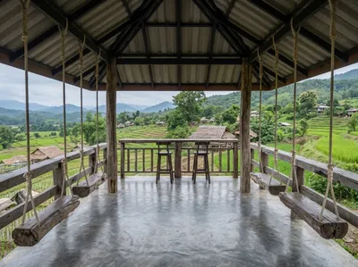
Log swings hanging from a covered deck above the fields south of Pai, with food and drinks to match the view. Quieter than anywhere in town.
Open in Google Maps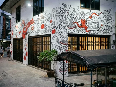
Nong Beer Restaurant
Pai, 131 km in
A Pai standby just off the walking street, easy to spot from the food mural covering the front wall. Thai and western on the one menu, all day.
Open in Google Maps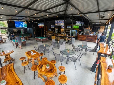
Lost Texan Restaurant
Pai, 131 km in
Open-sided bar in Pai with a pool table, screens on the back wall and a menu leaning heavily American. A reasonable refuge when the rain sets in.
Open in Google Maps
Stay6
Him Naam Pai
Pai, 121 km in
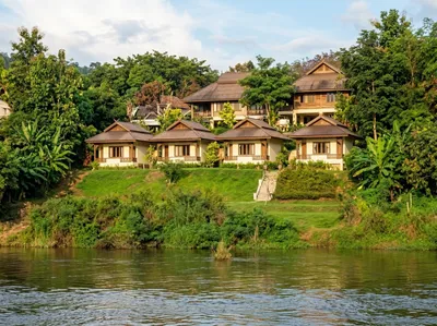
Thatched bungalows on the bank above the Pai river, a few kilometres out of town. The name means riverside, and that is exactly what you get.
Open in Google Maps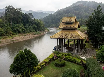
Pai River Mountain Resort
Pai, 122 km in
Lawns running down to the Pai river with hills behind, a few kilometres south of town. Set up for people who came for the river rather than the bars.
Open in Google Maps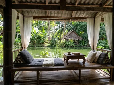
Bueng Pai Farm
Pai, 130 km in
Huts around a fishing pond on a working farm just south of Pai, with salas out over the water. Slow and green, and a long way from the walking street in spirit.
Open in Google Maps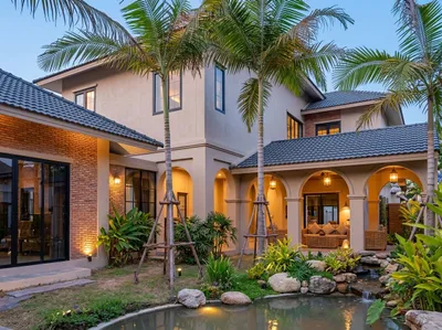
Arch Casa Design Hotel Pai
Pai, 131 km in
Brick and white villas set around palms and a small pond, a short walk from the middle of Pai. More design hotel than backpacker guesthouse.
Open in Google Maps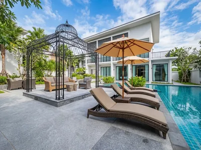
Ai Pai Hotel
Pai, 131 km in
A pool, loungers and an iron pavilion right in Pai town, a couple of minutes from the night market. Useful for the hottest part of the afternoon, when riding stops being fun.
Open in Google Maps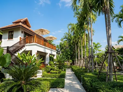
The Quarter Pai
Pai, 131 km in
White villas with timber balconies along a garden path in central Pai. Close to the walking street without being in the thick of the noise.
Open in Google Maps
Photos
More rides nearby
- Distance
- 199 km
- Climb
- 3,486 m
- Level
- Beginner
- Distance
- 223 km
- Climb
- 2,405 m
- Level
- Advanced
- Distance
- 177 km
- Climb
- 4,331 m
- Level
- Intermediate
- Distance
- 100 km
- Climb
- 1,490 m
- Level
- Beginner
In these riding guides
Chiang MaiMae Hong Son